Laser range finder uses span far beyond simple distance measurement, powering everything from military targeting systems to weekend golf games. These compact devices emit a laser pulse toward a target and measure how quickly the light returns, calculating distance based on the speed of light and round-trip time. This time-of-flight principle delivers accurate readings within a meter over distances of several kilometers. Today, professionals and hobbyists alike rely on laser range finders for surveying, forestry, construction, hunting, and industrial automation.
This guide breaks down the most impactful laser range finder uses across industries, explains the underlying technologies, and highlights what to consider when choosing the right device for your needs. You’ll also learn how environmental factors affect accuracy and which safety standards apply to different models.
Military Targeting and Reconnaissance Applications
Long-Range Fire Support for Snipers and Artillery
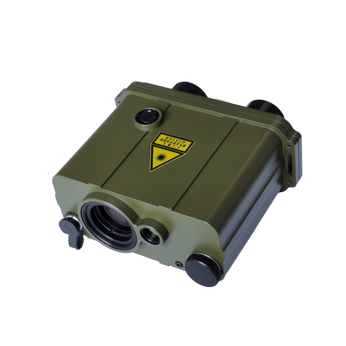
Laser range finder uses in the military center on delivering precise distance data to snipers and artillery units engaging targets far beyond visual range. Handheld military rangefinders typically operate from 2 km up to 25 km, feeding accurate distance readings into ballistic calculations for bullet drop and wind drift. This data is critical for achieving first-round hits at extreme distances where small errors lead to complete misses.
Many handheld military units integrate with binoculars or monoculars, combining magnified optics with instant range data. When paired with digital magnetic compasses and inclinometers, these devices also report azimuth, elevation, and target height for advanced fire control systems.
Vehicle-Mounted and Platform-Integrated Systems
More powerful rangefinders, capable of measuring up to 40 km, mount directly onto tanks, naval vessels, aircraft, and helicopter gunships. These systems integrate fully with thermal imaging, night vision, and daytime optics. The Barr & Stroud LF2, first used on the Chieftain tank in 1969, used ruby lasers to feed targeting data directly into fire control computers.
Modern platforms often include wireless or cable interfaces for seamless data transfer between units. Some advanced models use Doppler effect techniques to calculate a target’s relative speed, helping track moving vehicles or personnel.
Countermeasures and Operational Limitations
Military vehicles sometimes use laser-absorbing paint to reduce reflectivity and avoid detection. However, certain materials and natural surfaces return weak laser signals, making ranging difficult. Operators must account for these limitations and rely on reflectors or alternate targeting methods when natural returns are poor.
3D Scanning and Object Modeling
Time-of-Flight Scanners in Computer Vision
In digital modeling and computer vision, laser range finder uses include forming the foundation of time-of-flight 3D scanners. These systems capture thousands of distance points per second, building detailed depth maps of objects and environments. Unlike stereoscopic cameras that match features between two images, laser rangefinders directly measure depth, eliminating correlation errors and improving accuracy.
These scanners operate in single-face or full 360-degree modes, making them ideal for architectural modeling, virtual reality environments, and robotic navigation. High-end models achieve sub-millimeter resolution, suitable for precision engineering and quality inspection.
Multi-Angle Data Fusion for Complete Reconstructions
To create full 3D reconstructions, multiple scans from different angles are merged using specialized algorithms. These algorithms align overlapping data sets and minimize errors, producing seamless, high-fidelity models. This technique is widely applied in cultural heritage preservation, where statues, buildings, and archaeological sites are digitally archived with millimeter accuracy.
Many 3D vision systems rely on triangulation or phase-shift techniques rather than time-of-flight methods, achieving depth resolutions as precise as 0.1 mm for short-range applications.
Forestry and Environmental Surveying

Anti-Leaf Filters for Accurate Tree Measurements
Standard rangefinders often lock onto leaves or branches instead of intended targets like tree trunks, producing falsely short readings. Specialized forestry rangefinders solve this with anti-leaf filters that ignore partial or weak reflections, ensuring the laser locks only onto solid, distant objects.
Some models work with retro-reflectors, small mirrors placed on trees during forest inventories. The laser reflects strongly off the reflector, bypassing foliage entirely and delivering exact baseline measurements for plot mapping, volume estimation, and growth tracking.
Forest Inventory and Canopy Analysis
These tools support sustainable forest management by measuring tree height, distance between plots, and slope-adjusted distances without physically accessing every point. When paired with GPS and inclinometers, laser rangefinders help generate detailed forest maps for carbon sequestration studies, biodiversity assessments, and timber yield predictions.
Sports: Golf, Hunting, and Archery

Golf Distance Measurement and Slope Compensation
Golfers rely on laser range finder uses to determine exact distances to flags, hazards, and landmarks. Premium models from Bushnell, Leupold, and Nikon feature Pin-Seeking technology that prioritizes the closest small target, like a flagstick, even when background objects are present.
Many rangefinders include ARC (Angle Range Compensation) or slope adjustment, calculating horizontal distance when shooting uphill or downhill. This feature is critical for accurate club selection, though slope functions are banned in tournament play under USGA rules. Most models allow users to disable this feature during competition.
Another popular feature is JOLT, a vibration alert that confirms the target has been locked, helping users maintain focus through the viewfinder.
Hunting and Archery in Open Terrain
Western U.S. hunters rely heavily on laser rangefinders due to long shooting distances and open landscapes. Knowing exact range to game enables precise shot placement and compensates for bullet or arrow drop. Models from Leica, Zeiss, and Swarovski Optik offer long-range detection up to 2,000 yards, waterproofing, and ballistic calculators.
Eastern hunters typically work at shorter ranges in dense woods, where rangefinders are less critical. Even in these conditions, a rangefinder eliminates guesswork and improves ethical shot decisions.
Industrial Automation and Stock Management

Monitoring Steel and Bulk Material Levels
In industrial settings, laser range finder uses include automating measurements in harsh environments where traditional methods fail. Steel mills and foundries use these devices to monitor molten metal levels, slab positions, and coil diameters without physical contact, reducing wear and improving worker safety.
Mounted on cranes or fixed structures, rangefinders scan material piles from multiple angles, calculating volume based on 3D point clouds. This data feeds into inventory systems, enabling real-time tracking and reducing manual labor.
Integration in Production Line Control
Laser rangefinders monitor conveyor belt loads, detect object presence, and verify product dimensions. Their non-contact operation makes them ideal for continuous, high-speed production lines. In paper and textile manufacturing, they ensure consistent roll diameter and tension control.
These systems often use continuous wave phase-shift or interferometry for high accuracy at short ranges, where time-of-flight methods lack sufficient resolution.
Construction and Real Estate Measurement
Replacing Tape Measures with Digital Precision
Since Leica Geosystems introduced the first laser measuring tool in 1993, these devices have transformed construction and real estate workflows. A single operator can now measure room dimensions, ceiling heights, and property boundaries with just a line of sight, eliminating the need for a second person to hold a tape.
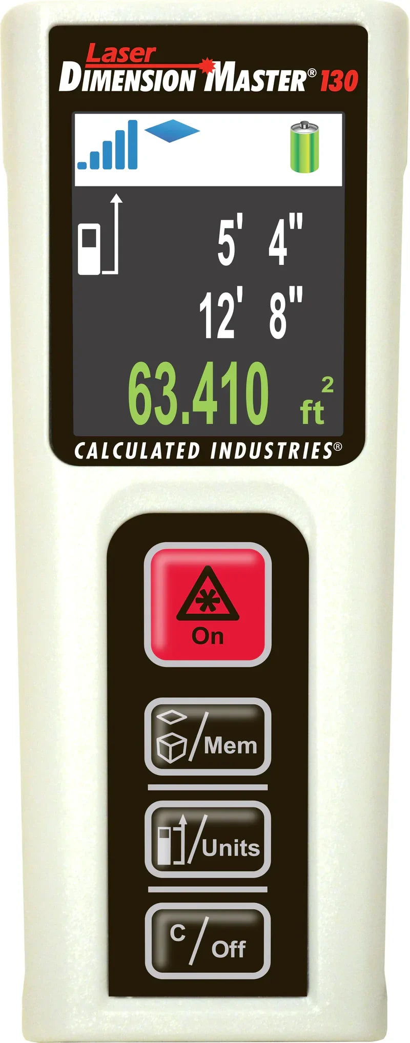
Laser distance meters used in construction typically measure up to 100 meters with accuracy between ±1 mm and ±3 mm. They are faster and more reliable than tapes, especially over long distances or in tight spaces.
Built-In Calculations for Area and Volume
Modern laser measurers include onboard processors that calculate area, volume, and Pythagorean distances for indirect measurements. For example, you can measure ceiling height by pointing at two corners of a wall, even without direct line of sight to the ceiling.
Contractors use these tools for estimating materials like drywall, flooring, and paint. Real estate agents generate accurate floor plans during property showings. Most models store multiple measurements and transfer data via Bluetooth to smartphones or tablets.
Technology Behind the Measurements
Time-of-Flight: Long-Range Distance Calculation
The most common method in laser rangefinders, time-of-flight, calculates distance using the formula D = ct/2, where c is the speed of light and t is the round-trip time of the laser pulse. Because light travels so fast, electronics must time pulses with sub-nanosecond precision.
Multiple pulses are fired and averaged to improve accuracy, especially in low-reflectivity conditions. This method excels in long-range applications like military targeting and surveying but lacks precision at sub-millimeter scales.
Phase-Shift and Interferometry for High Precision
Multiple frequency phase-shift systems measure the phase delay of modulated laser light, solving simultaneous equations to determine distance with sub-millimeter precision. Interferometry detects tiny changes in distance by measuring interference patterns between split laser beams, making it unmatched for monitoring micro-movements in machinery, bridges, or laboratory equipment.
Atmospheric Absorption for Environmental Sensing
A niche method uses light attenuation by atmospheric absorption. By measuring how much laser light is absorbed by gases like H₂O, CO₂, or CH₄, these rangefinders estimate both distance and atmospheric composition. This approach is useful in planetary exploration and air quality monitoring.
Accuracy Challenges and Environmental Factors
Beam Divergence and Atmospheric Distortion
Even with a narrow beam, laser light spreads over long distances due to divergence. Over 1 km, a 3 mrad beam can widen to over 3 meters in diameter, increasing the chance of hitting unintended objects.
Scintillation and beam wander, caused by temperature gradients and water droplets acting as lenses, further distort the beam path. This creates mirage effects where targets appear to vanish or shift, leading to failed or inaccurate readings.
Wind and Heat Bubbles Affecting Long-Range Shots
Transverse winds push rising heat bubbles laterally, creating moving refractive zones that bend the laser unpredictably. This is especially problematic when ranging targets near the ground over open desert or asphalt. Operators must aim steadily and take multiple readings to filter out anomalies.
Partial reflections from foreground objects like leaves can trigger early returns, resulting in readings that are too short. High-end models use signal processing to detect and reject these false echoes.
Safety and Device Classification
Class 1 and Class 2: Eye Safety Standards
Laser rangefinders are classified by output power and potential hazard. Most consumer models fall under Class 1 (inherently safe) or Class 2 (safe due to blink reflex), making them suitable for general use. However, never look directly into the beam or point it at people, vehicles, or aircraft.
Military and industrial rangefinders often exceed Class 2 limits and require protective eyewear and controlled operation. Always follow manufacturer guidelines and local regulations when using high-power devices.
Avoiding Eye Exposure and Regulatory Compliance
Even low-power lasers can cause retinal damage with prolonged exposure. Always use the device as intended, avoid reflective surfaces, and store it securely. In many countries, pointing lasers at aircraft is a criminal offense.
Choosing the Right Rangefinder by Use Case
Match Device to Application Needs
Not all laser rangefinders perform the same way. Consider these factors when selecting one:
- Range: 100 m for construction versus 25 km for military
- Accuracy: ±1 mm for surveying versus ±1 m for hunting
- Environment: Waterproofing, fog resistance, anti-leaf filters
- Features: Slope compensation, Bluetooth, data logging
- Battery life: Especially important for extended field use
Golfers benefit from Pin-Seeking and JOLT features. Hunters need long-range detection and ballistic aids. Construction professionals prioritize area and volume calculation. Surveyors demand high angular stability and tripod compatibility.
Frequently Asked Questions About Laser Range Finder Uses
What is the most common laser range finder use in the military?
Military forces primarily use laser rangefinders for sniping and artillery fire support. Handheld units operate from 2 km to 25 km, while vehicle-mounted systems reach up to 40 km. These devices feed precise distance data into ballistic calculators for first-round accuracy at long range.
How accurate are consumer laser rangefinders for golf?
Consumer golf rangefinders typically offer accuracy within one yard at distances up to 1,000 yards. Premium models include Pin-Seeking technology and JOLT vibration confirmation. Slope compensation features calculate horizontal distance for uphill and downhill shots, though this function is banned in tournament play.
Can laser rangefinders measure distance through trees?
Standard rangefinders often struggle through foliage because leaves and branches reflect the laser pulse and cause early returns. Specialized forestry rangefinders solve this with anti-leaf filters that ignore partial reflections. Using retro-reflectors placed on target trees also helps bypass foliage entirely.
What is the maximum range of industrial laser rangefinders?
Industrial laser rangefinders vary widely based on application. Construction models typically measure up to 100 meters with ±1 mm to ±3 mm accuracy. Steel mill and bulk material monitoring systems can scan piles from multiple angles at ranges of several hundred meters, feeding volume data into inventory management systems.
Are laser rangefinders safe for everyday use?
Most consumer laser rangefinders fall under Class 1 or Class 2 safety classifications and are considered eye-safe under normal use. However, you should never look directly into the beam or point it at people, vehicles, or aircraft. Military and industrial models exceed Class 2 limits and require protective eyewear.
How do environmental factors affect laser rangefinder accuracy?
Beam divergence, atmospheric scintillation, and heat-induced mirages all reduce accuracy at long range. Partial reflections from nearby objects can trigger false short readings. Wind and temperature gradients bend the laser unpredictably, especially over open terrain on hot days. Taking multiple readings helps filter out anomalies.
Key Takeaways on Laser Range Finder Uses
Laser range finder uses span military, industrial, scientific, and recreational applications, making these tools among the most versatile measurement devices available today. Understanding the underlying technology, whether time-of-flight, phase-shift, or interferometry, helps users select the right device and interpret results correctly.
Environmental factors like beam spread, mirage effects, and partial reflections must be accounted for, especially at long range. With proper use and safety awareness, laser rangefinders deliver fast, accurate measurements that save time and improve decision-making across countless industries.
Your next step is to identify your primary use case and match device specifications accordingly. Start by listing your required range, accuracy needs, and environmental conditions, then compare models that meet those criteria.